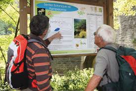
How to recognise the different essences of the Viaur Valley? An arranged path of 5km will lead you into the bottom of the Valley, along the river for a enjoyable promenade.
- Starting point: Thuriès Camp site – Pampelonne
- Distance travelled: 5km
- Time: 1h15
- Min. Altitude: 230m, Max. Altitude 387m
- Difficulty: easy
- Signs: follow the signs “sentier botannique”.